
For retailers and loss prevention
See every store floor.
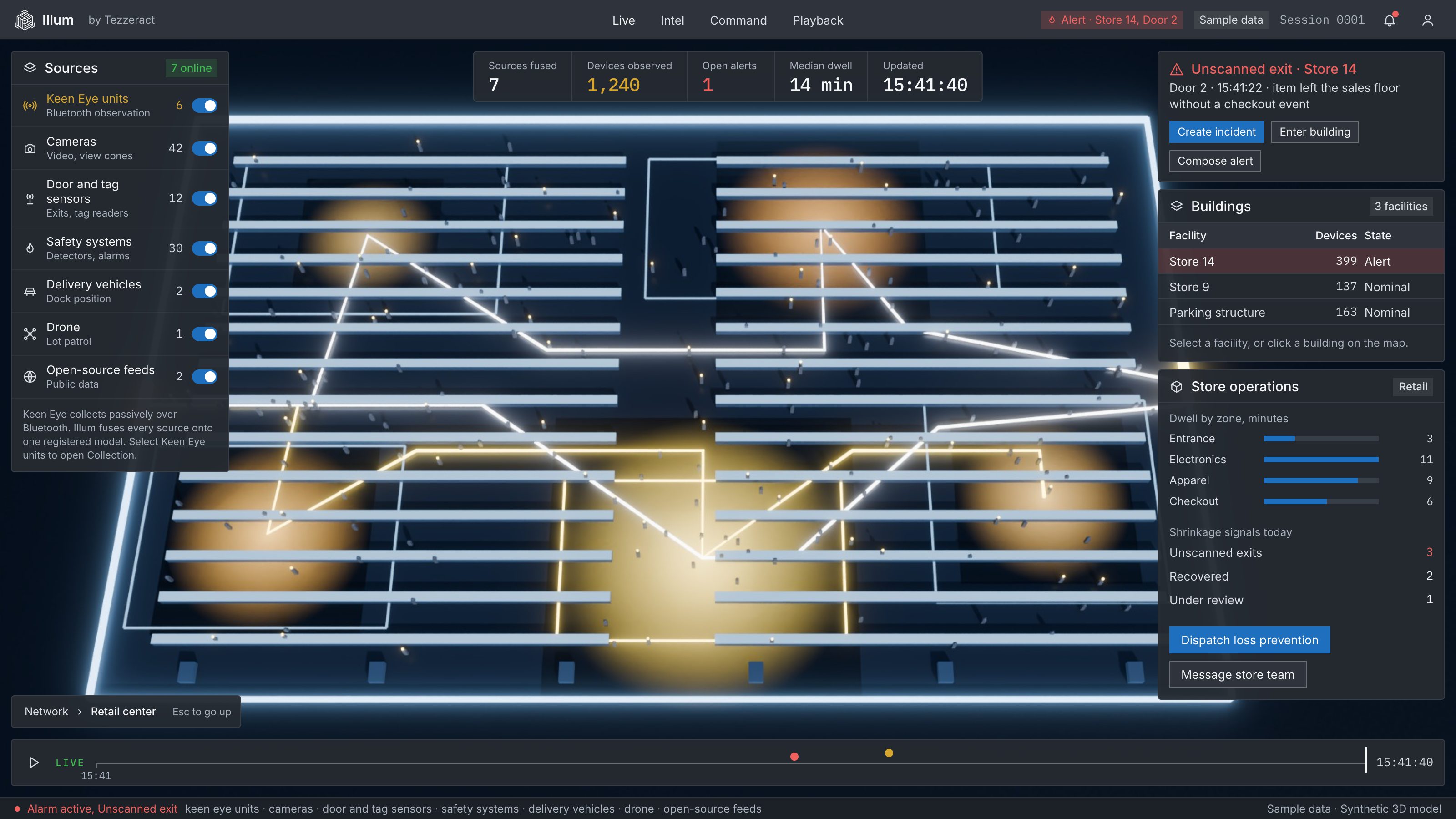
Illum turns each store into a live floor map, flags unusual movement early, alerts the nearest team member, and clears a floor fast when it has to. Beyond the store, drone delivery routes are planned in 3D.
01 / The store
One map per store, the same tools in every one.
Zones, staffing and traffic on the floor plan, built for a chain.
02 / Dwell
Where they dwell.
Heat shows the shelves that hold attention.
03 / Pattern
A risk pattern, early.
Behavioural and spatial signals can flag an unusual path before an incident.
04 / Alert
Staff alerted.
The alert reaches the right person with the location.
05 / Clear
If a floor must be cleared.
The model shows where devices are observed and how to route people out.

How it works
Every store floor, the same tools.
01 / SEE
Every aisle, every zone.
Dwell, shopper flow and department zones on the floor plan, the same in every store.
Operational flow optimization
Adaptive staffing and routing
02 / FLAG
An unusual path, early.
Door and tag signals and movement patterns flag a risk before an incident.
Real-time theft prevention
Silent alerting before escalation
03 / CLEAR
Clear a floor fast.
When a floor must be cleared, the model shows where devices are observed and routes people out.
Revenue intelligence
Evacuation routes and associate alerts
Integrates with retailers’ existing IoT and analytics stacks. Counts are devices observed, not unique people.
Beyond the store
Plan the last mile in 3D.
01 / PLAN
A route over the real buildings.
Depots, drop points and flight paths sit on the same 3D model as the streets and rooftops.
Routes on the 3D model
Depot and drop-point zones
02 / ZONES
Zones on the model.
Geofenced zones are drawn on the 3D model, so a route is planned with them in view.
3D geofences
Zone alerts
03 / FOLLOW
One view from depot to door.
The drone’s position joins the picture, so operations follow each delivery to the drop point.
Drone video and telemetry overlays
Playback
Drone and routing feeds join through integration. Same layer as the defense and law-enforcement view.
© 2026 Tezzeract, Inc. All rights reserved. ILLUM and KEEN EYE are trademarks of Tezzeract, Inc. Near real time means within 500 milliseconds.