
For defense and government operations
One command picture, in 3D.
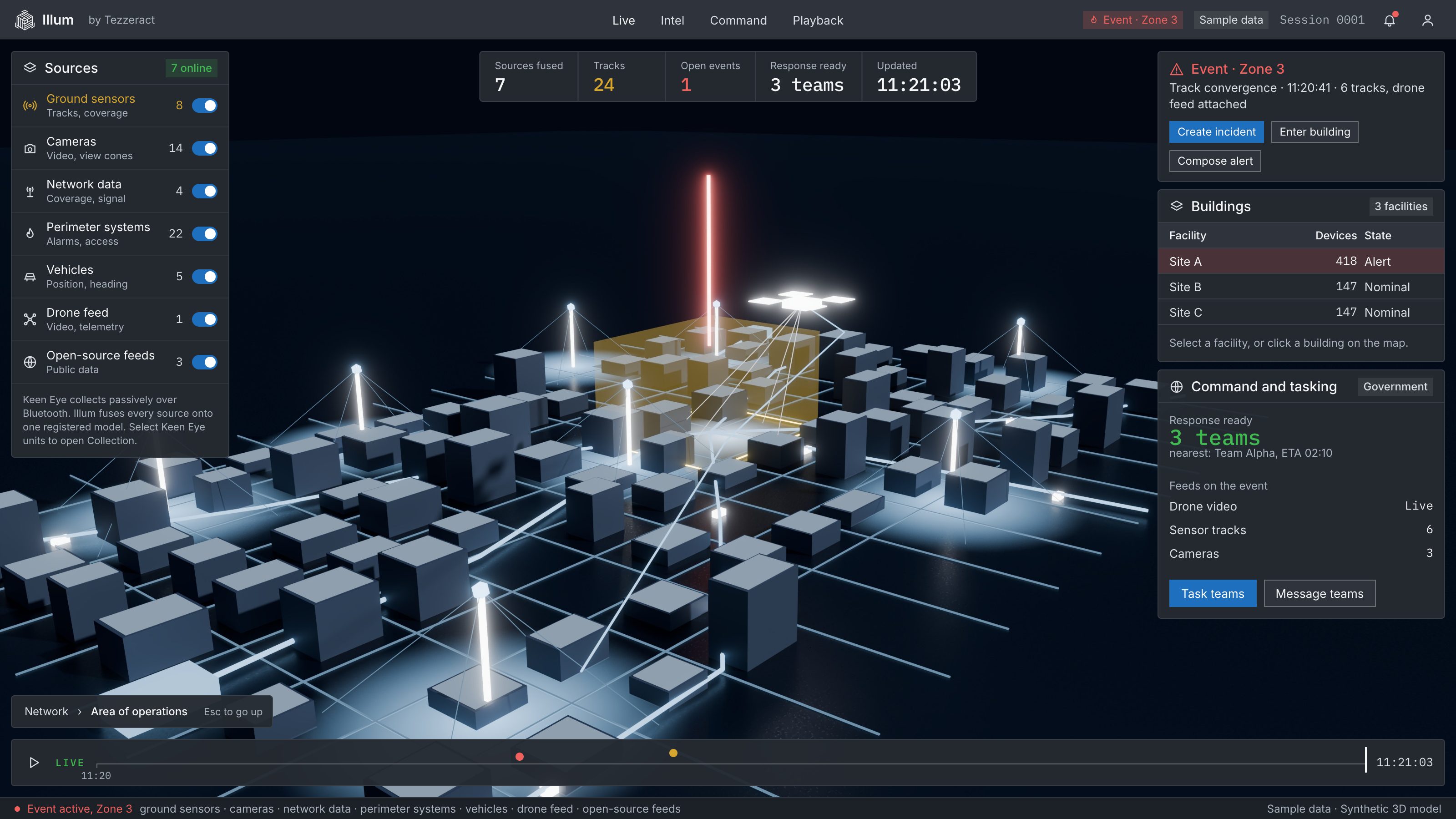
Illum puts sensors, vehicles, devices, cameras and drone feeds on one 3D map, so detection reaches authorized action faster.
01 / Sensors
Every sensor, one map.
Ground sensors, cameras and network data place what they see on a 3D model of the area.
02 / Tracks
Tracks converge.
Vehicles and devices from every source join one picture, with their history.
03 / Drone feed
Drones join the picture.
Drone video and position overlay on the map, so a team sees from above and on the ground at once.
04 / Flag
One event flagged.
An event inside a geofence is marked for review.
05 / Respond
Authorized teams act.
Operators and field teams work from the same picture, and the response is tasked from it.

© 2026 Tezzeract, Inc. All rights reserved. ILLUM and KEEN EYE are trademarks of Tezzeract, Inc. Near real time means within 500 milliseconds.