
The platform
See the whole place. Act inside any boundary.
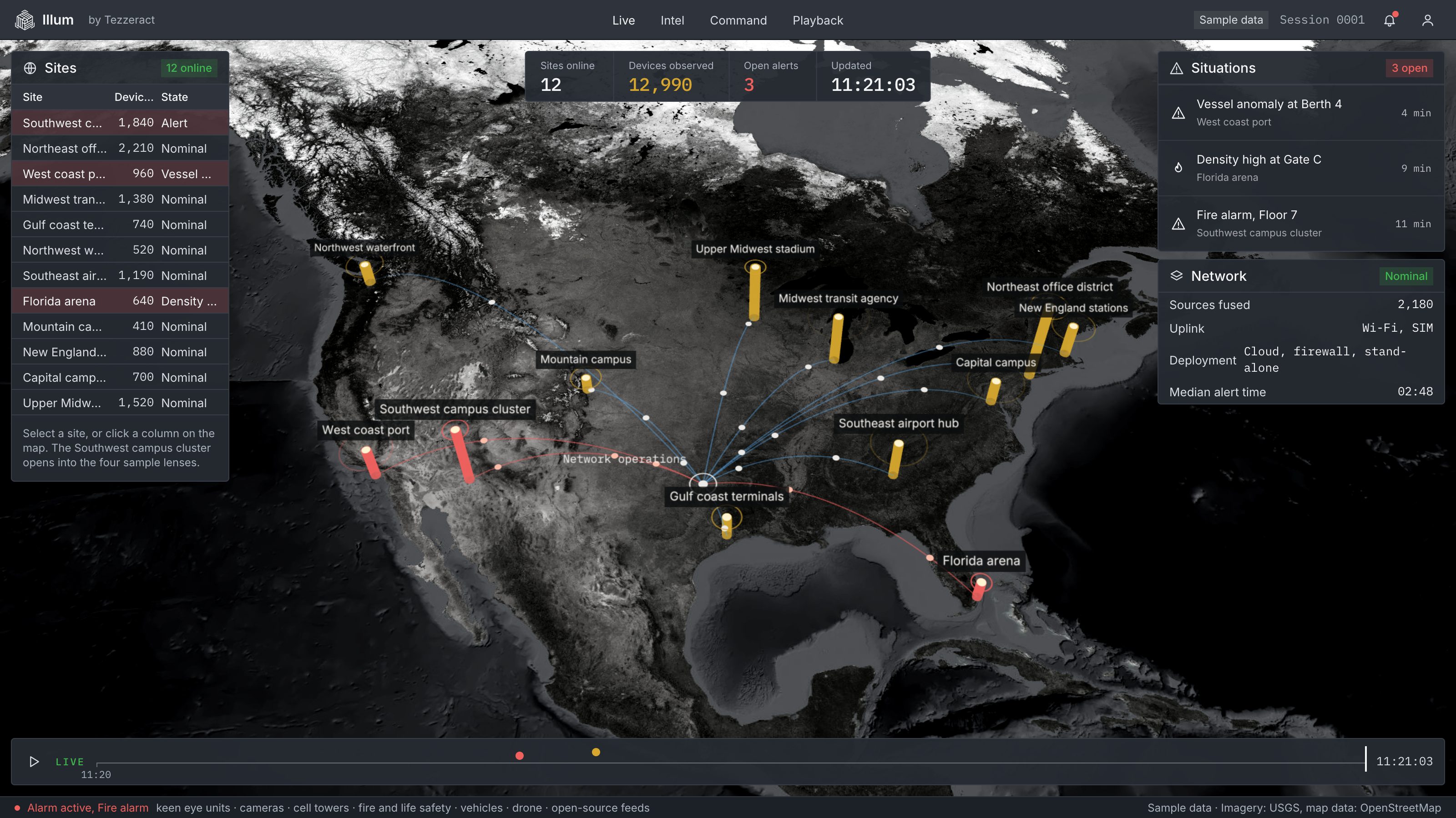
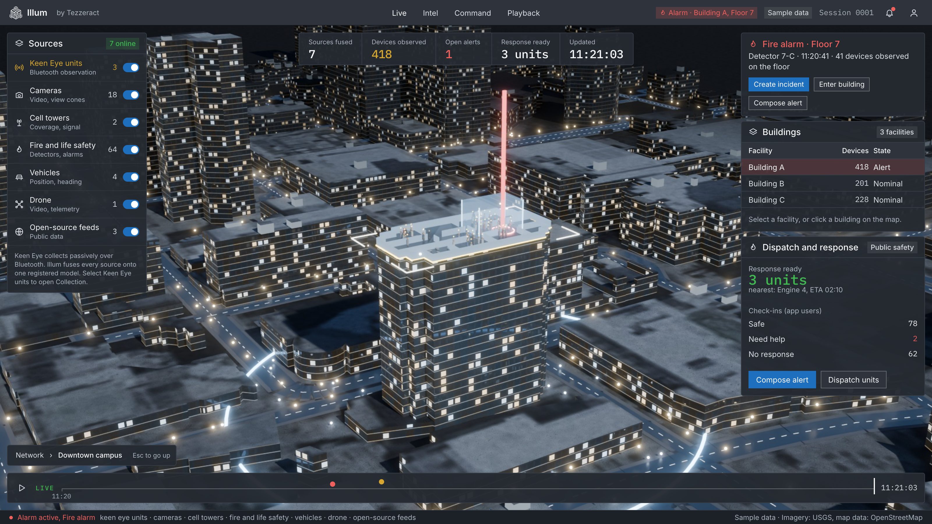
Operators get a 3D map down to the floor, live positions, camera and data layers, and a time bar to replay it. Draw a geofence, then alert and message the enrolled people inside, and watch the check-ins come back.
01 / See
Every layer, one picture.
Ground, buildings, roads, floors, devices, cameras, drones and feeds sit on one model, so an operator reads a situation instead of assembling it. Where others monitor, Illum orchestrates.
02 / Which floor
Which floor.
The right floor, and every layer above and below it.
03 / When
And when.
Time is a layer. Scrub back to see where a device was and how it moved.
04 / Every source
From every source.
Phones, sensors, network data and live feeds converge on one model. Keen Eye adds structured geospatial data.
05 / Act
Then act.
Draw a geofence around a floor, a room or a region. Alert and message the enrolled people inside, and ask if they are safe.
Position
What Illum is, and what it delivers.
Illum is
A patented, AI-powered intelligence platform. Near real-time 3D geospatial simulation. A system that turns risk into insight, and insight into action. It located 50,000 phones across 96 floors in under 5 seconds.
What it delivers
Preemptive intelligence instead of reactive monitoring. Operational and revenue insight from the same data. One resilient system that works with the infrastructure you already have.
© 2026 Tezzeract, Inc. All rights reserved. ILLUM and KEEN EYE are trademarks of Tezzeract, Inc. Near real time means within 500 milliseconds.